Starting point:
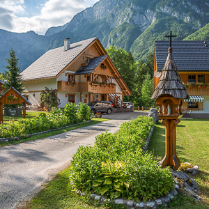
In Ribčev Laz village at Lake Bohinj turn right over a bridge towards Stara Fužina. Before a bridge in Stara Fužina signposts direct you to the left towards Vogar and Voje. Follow this road, which soon leads to the spot where road toll is collected in summer-time. Pay the toll and continue ascending. Go left on the first crossroad (Voje valley is to the right) and right at the next one (Vogar alpine meadow is straight on). There is a parking lot in front of Blato alpine meadow at the end of the road (1150 m).
Description:
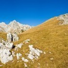
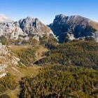
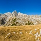
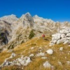
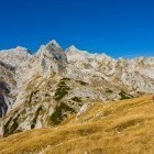
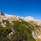
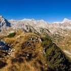
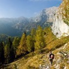
From the parking lot make a few steps towards Blato alpine meadow. As soon as you spot the meadow leave the road and proceed on a footpath on your right. The path goes parallelly with the forest road and crosses it after about 400 meters. The path is poorly visible in this section, so you should orient according to the forest road that goes below you on your right. After a while you will find a unmarked path, which turns left and begins to ascend a bit more steeply. From here on the path is nicely visible. Follow it past a hunting shack to the beautiful Krstenica alpine meadow. At Krstenica the path gets slightly lost; head towards north-west to a valley between Stog and Ogradi. Soon you will find a nice path, which leads you past larch trees to a lovely little basin. This is Jezerce alpine meadow - 'squeezed' between Adam and Eve (the towering walls on your right) and Ogradi (on your left). Look for a water trough on the right side of the meadow where a nicely visible path starts to ascend towards 'Jezerski Preval' saddle. Follow this path only for a short while and then turn left into a tiny valley below scree-slopes in the direction of Škednjovec (the highest pointed mountain far ahead of you). At first the path is almost non-existent, but later a narrow path reveals and takes you to the end of the valley across a flat terrain. Turn right at the end, ascend a bit quicker and follow a more or less traced footpath towards 'Mišeljski Preval' saddle. Once you come to the grassy slopes below Prevalski Stog (at around 1900 altitude meters), a small valley opens on your right and a poorly visible path goes through it. It goes between the 'bare' Adam summit (2012 m) on the right and the 'hairy' Eva (2019 m) on the left. Ascend to both summits, which have steep walls on their south sides. Turn northwards and reach the grassy summit of Prevalski Stog along an easy ridge. The view is marvelous. There are almost no marked paths in this region, therefore you will not meet many other hikers here. It is really peaceful and simply marvelous!
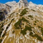
Descend from the summit towards north-west. A gentle slope gradually becomes steeper and the grass can be quite troublesome when wet. Join a marked path at 'Mišeljski Preval' saddle and go left towards 'Lazovški preval' saddle. Across a flat terrain you will reach 'Lazovški Preval' saddle where the marked path turns right towards Laz alpine meadow. You should keep to the saddle and proceed on a footpath through dwarf pines straight towards Ogradi summit. At first the path is ascending gently, but later it starts to rise across a steep gully. You will have to use your hands to climb up occasionally; be careful due to crumbling rocks. At all times you should follow the ridge, which is occasionally narrow and partly exposed. Quite fast you will reach the rounded summit of Ogradi. Again you are rewarded with spectacular views and comfortable grass for a deserved rest.
Descend across the grassy slope southwards. Follow a nicely visible path, which turns right at an abandoned alpine meadow and takes you to a wider path, which goes from Laz alpine meadow to Krstenica alpine meadow. You can either go right and return to the starting point across Laz alpine meadow or turn left and come to Krstenica from where you descend back to Blato.
Highest point/summit:
Prevalski Stog: 2079 m
Ogradi: 2087 m
Duration:
Blato alpine meadow - Krstenica alpine meadow : 1.15 h
Krstenica alpine meadow - Prevalski Stog (past Adam and Eva): 2.30 h
Prevalski Stog - 'Lazovški preval' saddle: 1 h
'Lazovški preval' saddle - Ogradi: 45 min
Ogradi - Blato alpine meadow (past Krstenica): 2.30 h
Total: 8 h
Difficulty:
3 - The route is technically easy (apart from a short section of the ascent towards Ogradi). Between Prevalski Stog and 'Mišeljski Preval' saddle there is a steep grassy slope, where more caution is needed if the grass is wet. Ascent from 'Lazovški Preval' saddle to Ogradi demands some light climbing (1st level) and is partly exposed. Because the tour runs on (occasionally) poorly visible unmarked paths, a good sense of orientation is a must.
Type of path:
Unmarked path - Almost the entire tour takes place on unmarked paths. Mostly they are well visible but they turn into pathless areas in some places. The path from 'Mišeljski Preval' to 'Lazovški Preval' is marked.
Gallery


-
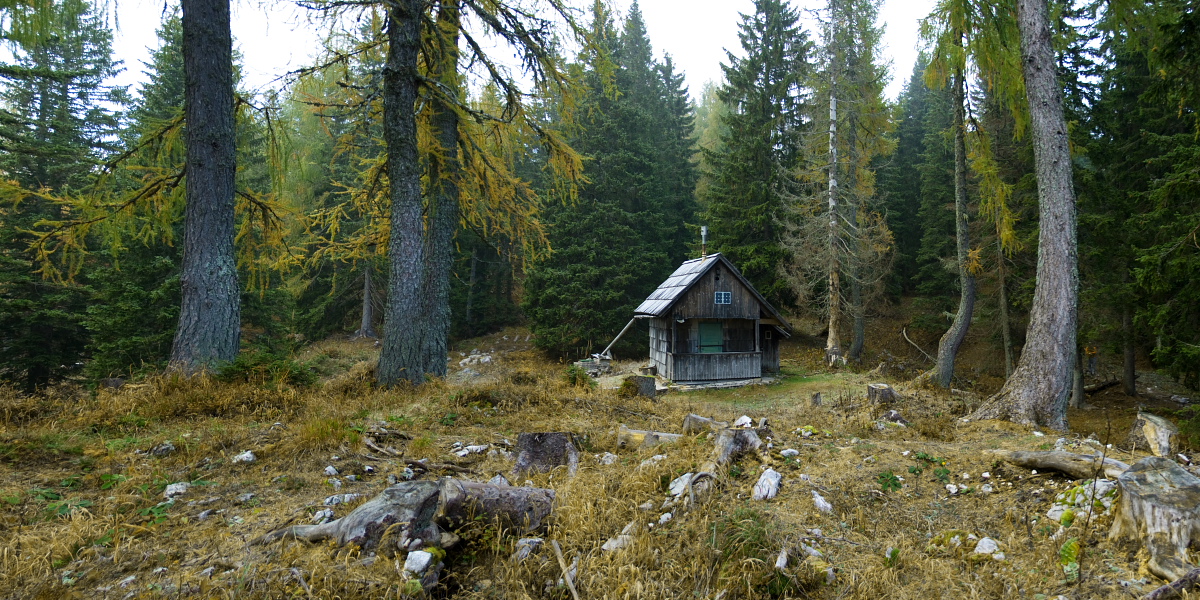
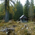
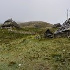
Hunters hut below Krstenica alpine meadow -

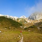
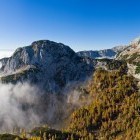
Krstenica alpine meadow above Bohinj -
Jezerce alpine meadow -
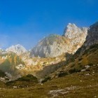
The wall of Adam above Jezerce alpine meadow -
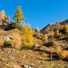
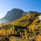
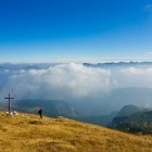
Beautiful fall colours above Bohinj -
View back towards Ogradi -
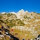
On the way towards Adam and Eva -
View towards Ogradi and Debeli vrh from Adam -
View towards Jezerski Stog from Adam -
Adam and Debeli vrh -
Just below the summit of Prevalski Stog -
View towards Velo polje -
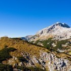
The "sharp" Mt. Škednjovec is always in front of us -
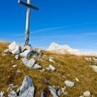
On the summit of Prevalski Stog -
Descent towards Mišelj saddle -
Descent towards Mišelj saddle -
Marked path towards Laz saddle -
Romatnic! -
The path towards Ogradi from Laz saddle -
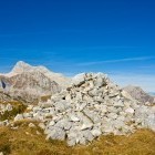
The summit of Ogradi -
The summit of Ogradi -
Descent from Ogradi towards south -
View towards Triglav -
Descent towards Laz alpine meadow