Starting point:
Volaka village near Hotavlje in Poljanska valley (around 550 m). On the main road 'Škofja Loka – Žiri' turn right in Hotavlje village towards Cerkno ski resort. Drive through the village, go right on the first crossroad (in the direction of a green signpost for the path to Blegoš from Čabarče), and left on the second one (towards Volaka and Čabarče). Two 'Y-shaped' crossroads follow: go left on the first one and right on the second one (continue along a stream). Go on for about 1 km from the second crossroad and park by the road (in front of the last houses in Volaka village, where the road crosses a stream and turns back for 180 degrees).
If you wish to shorten the trip and are not interested in a circular route, you have two other options:
2) From Hotavlje follow the green boards for the path to Blegoš from Čabarče. Ascend on the asphalt road and park just below Likar farm. Ascent and descent take place on the below described route of descent across the Likar meadow.
3) From Hotavlje follow signposts for Leskovica (or Cerkno ski resort). Once in Leskovica go past the church and continue on a dirt road for about 2 km to a large parking lot. Ascend and descend past 'Zavetišče Na Jelencih' shelter.
Description:
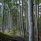
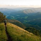
From the above mentioned parking lot continue on an asphalt road to the last houses in Volaka (where the road crosses a stream and turns back for 180 degrees). You will spot a signpost for Blegoš here. Pass by the houses on their left side and proceed on a path towards a forest, where you keep right. Although the path is clearly visible and marked the whole time, the markings at about 820 altitude meters can mislead you. If you come to a marshy area (where the path suddenly ends), simply cross the stream and you will find the right path again. After that you come to a large parking lot (option 3), where a dirt road from Leskovica comes. Follow the signposts to 'Zavetišče Na Jelencih' shelter. Above the shelter the path leads you to a cart road again and go in the direction of 'Koča Na Blegošu' hut. Here you come out of the forest and start enjoying the view. From the hut continue along a grassy path and ascend a bit faster to the bare and very panoramic summit.
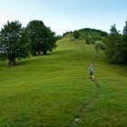
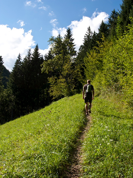
From the top descend across the grassy slope to a bunker where you turn right in the direction of the next bunker and follow a path into the forest. At first you go through a dark and dense spruce tree forest which is later replaced with incredibly charming and light beech trees, which surround you the whole way down. Follow the signposts to Čabarče on crossroads. Keep to some kind of a 'ridge' and come to Likar farm across rather steep and panoramic meadows. Behind the farm (just before the asphalt road goes into the forest – the parking lot of option no. 2 is here) turn to the right onto a clearly visible cart road across a meadow. The markings end here. Follow the cart road until a footpath branches of to the right and it takes you to the next meadow a bit lower down. At the end of this meadow go right onto a tractor road, cross a stream and continue on the path straight down to the asphalt road in Volaka, where you have left your car.
Highest point/summit:
Blegoš: 1562 m
Duration:
Volaka - Blegoš (past 'Zavetišče na Jelencih' shelter): 2.30 h
Blegoš - Volaka (across the 'Likar meadow'): 2 h
Total: 4.30 h
Difficulty:
2 - The entire route is technically easy.
Type of path
Marked path - A part of the descent is unmarked (between Likar farm and the start point in Volaka).
Gallery
-
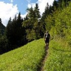
Blegoš - Start of the path at Volaka hamlet -

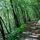
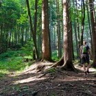
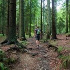
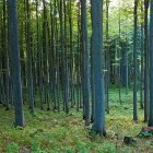
Blegoš - Ascent through the forest -
Blegoš - turn right here -
Blegoš - Towards "Na Jelencih" shelter -
Blegoš - Ascent through the forest -
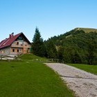
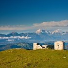
Hut on Blegoš -
The upper part of the ascent to Blegoš -
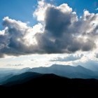
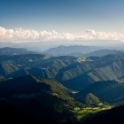
View from the summit of Blegoš towards Porezen -
Škofja Loka hills -
The last rays of sun on Blegoš -
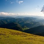
View from the summit of Blegoš towards Kamnik-Savinja Alps -
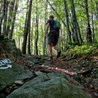
Blegoš - During the descent -
Blegoš - Descending along a "cute" ridge -
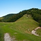
Blegoš - Meadows above Likar farm -
Blegoš - Meadows above Likar farm