How to get there:
Between Tolmin and Kobarid turn off the main road towards the village of Kamno and cross the Soča river. In the village go to the left and you will immediately spot a signpost for Selce. Ascend on the road and you will soon come to Selce village. Park in village at a marked spot. There is little space.
Description:
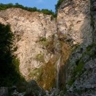
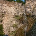
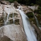
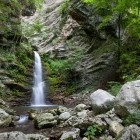
Go westwards along the edge of the village. At the last houses turn left and reach the edge of the forest on a grassy dirt road. Cross a fence, march into the woods and start to descend on a very narrow path across a steep terrain. The danger for slipping is grave; a sure step is necessary. Descend to the Malenšček stream carefully, cross it and you will see a grave of an unknown Russian soldier. Turn left and you are already under the 100 meters high wall of Brinta waterfall (104 m). In the summer-time only a small amount of water falls over the majestic wall and it resembles an enormous shower the droplets of which spray around before they hit the ground. Standing underneath it is an amazing feeling.
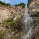
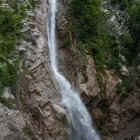
Return back to the grave of the Russian soldier and continue left from the stream. At first the path rises a bit, but later it descends slightly toward a rocky scree slope. Cross the scree slope and the roaring of more watery Gregorčič waterfall (88 m) can be heard louder and louder. The path before the waterfall gets very difficult. High above the stream bed of Volarja you will have to climb across a steep terrain which is pretty tough and slippery, since the waterfall sprays all around. A fixed rope helps us in one place, but otherwise the path is poorly secured and appropriate only for skilled mountaineers. It depends on the water level how close to the waterfall can we get, but do not be too brave. The rocks are slippery and there are a few more waterfalls underneath the big one! Careful!
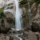
Those with an adventure spirit, can of course explore other smaller waterfalls that both streams create in their wild current towards Soča river. Otherwise return to Selce the same way.
Basic info:
Duration: at least 2 h
Length: 3.5 km
Altitude difference: 120 m
Type of path: very demanding partially marked path
Gallery
-
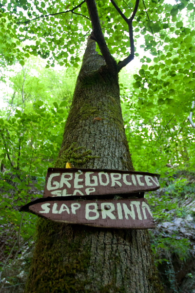
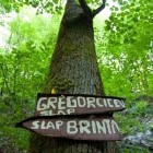
Signpost -

Brinta waterfall -
Brinta waterfall -
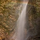
Rainbow on Brinta waterfall -
Brinta waterfall -
Brinta waterfall -
Gregorčič Waterfall -
Waterfalls below "Gregorčič" -
Waterfalls below "Gregorčič" -
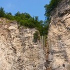
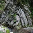
Rock layers -
One of the waterfalls on Malenšček stream