Starting point:
From Kranjska Gora drive towards Bovec (or Vršič mountain pass). Drive past Jasna lake and then you have two options:
1. Park by the road in front of a bridge over Velika Pišnica river (before the road starts to ascend steeper – at about 860 altitude meters).
2. Continue towards Vršič pass and park just before the 3rd hairpin turn of the Vršič road (about 1020 altitude meters).
Description:
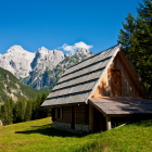
If you start from the parking lot 1, simply follow the wide road on the right bank of Velika Pišnica river. After a half an hour a path across 'Kačji Graben' branches off on the left. Continue straight and in another half an hour you come to Krnica mountain hut, where a nicer and more panoramic path to Špik starts to ascend (across 'Gruntovica'). The access to Krnica mountain hut is even shorter if you start the tour at parking lot 2 (the third hairpin turn on Vršič road). Turn left just before this hairpin onto a dirt road. It goes down and takes you to a stream and onwards across a wide meadow. At the end of the meadow you merge with the path from parking lot 1 and ascend to the right towards Krnica hut.
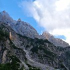
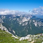
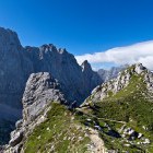
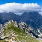
Markings by the hut direct you to the left. The path ascends gently and it soon comes out of the forest. Follow a torrent riverbed 'Gruntovica', which changes drastically at heavy rain and also changes the path a bit - pay attention to the markings. Leave 'Gruntovica' at about 1400 altitude meters and cross a scree slope to the left. The path winds around 'Gamsova Špica' summit and you rise to a panoramic ridge. The majestic walls of Prisojnik, Razor and Škrlatica surround us all the way. There is also a magical larch tree forest, which is, of course, most beautiful in its golden autumn-winter garment.
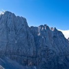
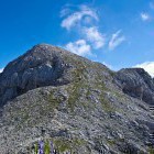
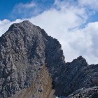
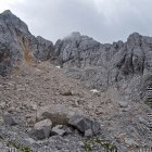
The path to the ridge is fairly easy, but then there are a few passages secured with steel cables. Go up the ridge to the rounded Lipnica summit, then descend a bit and you will see the steep summit 'pyramid' of Šipk. It looks pretty frightening from afar, but it is not as bad as it may look. The path leads across a steep and crumbling 'ravine' (a helmet is necessary) – there are no stemples or steel cables, you must help yourself with hands. You reach the summit quickly and there is a well-deserved '5 star' view!
Descent: Although the path through 'Gruntovica' is prettier, we prefer circular routes and will descend from Špik across 'Kačji Graben'. This path is steep, often slippery and runs across a wide scree slope at the top. Opinions clash when it comes to this path, but I personally think 'Kačji Graben' is more suitable for the descent than for ascent.
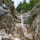
Go down from the Špik summit the same way to the scree slope at the foot of the summit pyramid. Then the scree slope guides you to the right and you can descend really fast. A bit lower the markings direct you to the left. Leave the scree slope past large rocky boulders and slowly come into a forest. The 'unpleasant' section of the path starts here. The steep descent takes place mostly in the forest, the ground is often slippery. Some stemples assist your passage over a few rocks. These sections will only be troublesome for people with extreme vertigo. An interesting waterfall – a lovely shower in summertime – is hidden on your right at the far end of 'Kačji Graben' (practically in the valley of Velika Pišnica).
Once you reach Velika Pišnica, you can go right (along the stream towards parking lot 1) or left (upstream to a large meadow where you go right and back to parking lot 2). It takes about half an hour on foot to reach both parking lots.
Highest point/summit:
Špik: 2473 m
Duration:
Parking 2 (3rd hairpin turn of Vršič road) - Krnica mountain hut: 30 min
Krnica mountain hut - Špik (across 'Gruntovica'): 4 h
Špik - Velika Pišnica (across 'Kačji graben'): 3 h
Velika Pišnica - Parking 1 or 2: 30 min
Total: 8 h
Difficulty:
3 - The path to Mt. Špik is steep, but technically not very demanding for such a high mountain. There are some short sections secured with steel cables on the path across 'Gruntovica'. The ascent across the summit pyramid leads through a steep and crumbling 'ravine' without any safety equipment (it is not exposed, but a helmet is necessary). The path through 'Kačji Graben' is often wet and slippery, which can be quite inconvenient. There are some passages over rocks where stemples assist you.
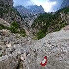
Type of path: Marked path
Gallery
-
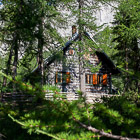
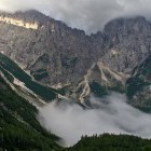
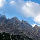
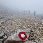
Špik - Foggy start in Krnica valley -

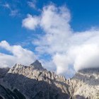
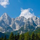
View towards Škrlatica group -
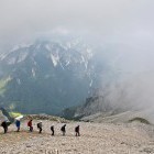
Špik - Ascent across "Gruntovica" -
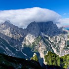
Špik - View towards Krnica valley -
Wall of Mt. Razor -
View towards Škrlatica group -
Mt. Razor -
Mt. Razor and Mt. Prisojnik from the path to Špik -
Mt. Prisojnik from the path to Špik -
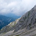
Path to Špik -
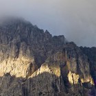
Mt. Škrlatica -
Path to Špik -
Path to Špik -
Path to Špik -
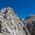
Špik - There are 2 short sections secured with steel cables -
Wild ridges of Martuljek mountains -
Wild ridges of Martuljek mountains -
Mt. Lipnica just before Špik -
On the way to Špik -
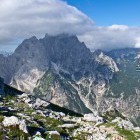
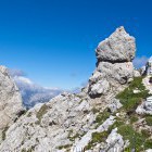
The summit "pyramid" of Špik -
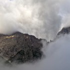
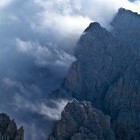
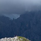
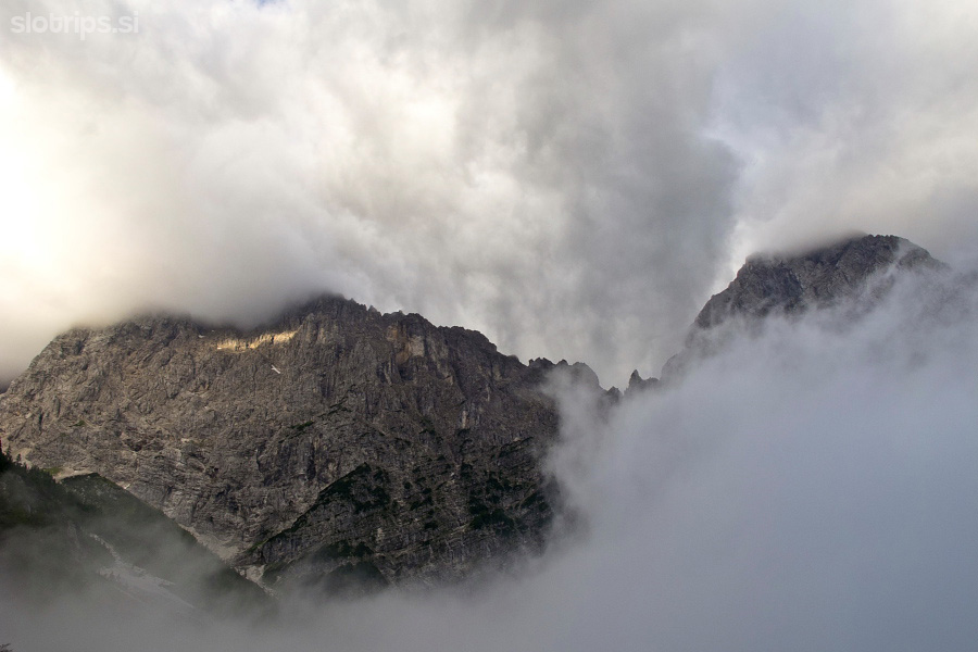
Fog is coming and taking our view :( -
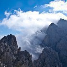
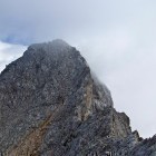
Špik - Foggy descent on the way to "Kačji graben" -
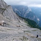
Špik - Scree slope towards "Kačji graben" -
Descent from Špik to "Kačji graben" -
Descent from Špik to "Kačji graben" -
Descent from Špik to "Kačji graben" -
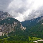
Špik - Valley of Velika Pišnica and Vršič pass in the back -
Špik - Waterfall at the end of "Kačji graben" -
In Velika Pišnica valley, just before the parking lot -
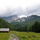
Meadow in Velika Pišnica - Krnica valley is in the back -
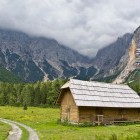
Špik, as seen from Gozd Martuljek on a sunny day