| asphalt, dirt road, trail | ||
Starting point:
Bovec or Kobarid. Our description begins in Bovec, but the gpx file provides both options.
Description:
From the center of Bovec descend directly towards south, between Stari Kovač inn and Alp hotel. Soon, you cross the main road (Bovec bypass) and proceed straight across the meadow right by the tiny sport airport. Follow the local footpath B1, which is occasionally marked with signposts on wooden stakes. Turn right after the airport and then after about 500 meter sharply to the left. The path descends directly to Soča River where it turns onto an asphalt road. Cross the bridge and ride through Čezsoča village. Keep right and proceed on the low traffic asphalt road that leads along the left bank of Soča river.
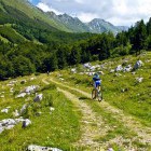
A nice road takes you to the village of Log Čezsoški where a quite rough dirt road replaces the smooth asphalt. Stay on the left bank of Soča, just under the Polovnik ridge. Follow this path all the way to a crossroad before Trnovo ob Soči village. Go left there (to the right you would come to Trnovo village) and overcome a steeper, more persistent slope. Stay on the dirt road until Magozd village and then you can breathe easier again. Ascend on an asphalt road to Jezerca village and onwards to Drežniške Ravne where you should pay close attention to the signposts to Zaprikraj alpine meadow. A dirt road with hair-pin turns goes to Zaprikraj alpine meadow and an incredible view onto the steep walls of Mt. Krn accompanies us throughout the ascent.
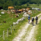
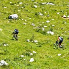
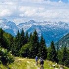
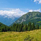
The road transforms into a cart road at Zaprikraj alpine meadow. It leads you across a streched meadow between Polovnik mountain ridge (on your left) and the Krn group (on the right) towards Predolina alpine meadow. Pay attention to the description boards that mark an open-air museum there. Fierce battles took place here at the time of the Soča front (1stWorld War). You can take a look at the remains of the former battle positions, caverns and shooting ditches that are scattered all over the area. The dirt road comes to an end at Predolina meadow. Keep to the right and follow the red-black markings of the ‘Walk of peace’ path. This interesting and narrow footpath crosses a steep slope and there are a few sections where you’ll have to get off the bike. You come to a path-split next to a deserted house, where you go right and begin to ascend steeply. Here, you have to continue on foot for half an hour and ascend 150 altitude meters.
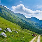
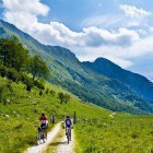
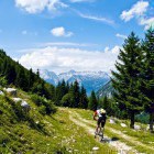
Once you reach Čez Utro mountain pass, the most stunning part of the tour begins. At first you cross the panoramic meadows of Golobar and then the trail turns into the forest. Beautifully winding and at first gently sloping mule track will surely impress you. It gets steeper in the lower section and the hair-pin turns become very narrow so that only the expert cyclers will manage them. At the bottom you cross a wider dirt road and descend all the way to Soča River. Fantastic water pools await you there and lure you in for an ‘ice-cool’ dip.
From here on, you proceed along the path on the left Soča bank to Jablenca hamlet. There you reach an asphalt road. However, soon you turn to the right onto a path that leads to the next footbridge over Soča River. Cross it and turn left straight after. You come to the confluence of Koritnica and Soča rivers and before long you cross Koritnica as well. Go up through a campsite and carry on along an asphalt road to the right. A local signpost on a wooden stake at the top of the hill (B5 path) guides you to the right onto a dirt road. First it goes through a forest and then straight to Bovec across a meadow with incredible views on Mt.Svinjak.
Warning: A part of the descent runs along a singletrail (foot-path). Ride slowly, use your front brakes and don't leave any trails with your rear wheel. Move from the path if you meet hikers. A warm 'hello' and a smile is very welcome.
A tip: If you want to discover the best and hidden MTB singletrails in the Soča valley - JOIN OUR MOUNTAIN BIKE TOUR!
Highest point:
Saddle 'Čez Utro': ca. 1305 m
Length (duration, km):
Bovec - Drežniške ravne - Zaprikraj alpine meadow: 3.15 h (31 km)
Zaprikraj alpine meadow - Golobar alpine meadow - Bovec: 2.15 h (16 km)
Total: 5.5 h, 47 km
Type of trail:
27% asphalt (12,5 km)
41% dirt road (19,5 km)
32% singletrail (15 km)
Gallery
-
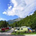
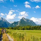
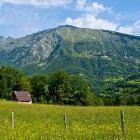
Start in Bovec -

Cycling path towards Čezsoča village -
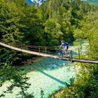
Crossing Soča at Čezsoča village -
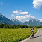
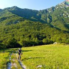
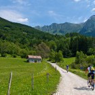
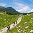
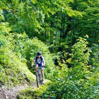
Between Čezsoča and Log Čezsoški village -
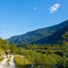
Dirt road on the left bank of Soča -
Below Polovnik ridge -
Below Polovnik ridge -
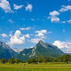
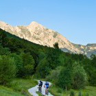
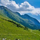
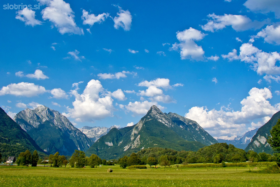
Mt. Krn -
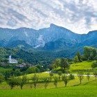
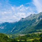
Drežnica village below Krn -
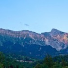
View towards Polovnik ridge -
View towards Polovnik ridge -
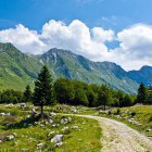
Start of the dirt road towards Zaprikraj meadow -
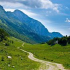
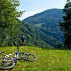
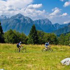
Zaprikraj alpine meadow below Mt. Krn -
Zaprikraj alpine meadow below Mt. Krn -
Zaprikraj alpine meadow below Mt. Krn -
Zaprikraj alpine meadow below Mt. Krn -
Zaprikraj alpine meadow below Mt. Krn -
Zaprikraj alpine meadow below Mt. Krn -
Zaprikraj alpine meadow below Mt. Krn -
Zaprikraj alpine meadow below Mt. Krn -
Zaprikraj alpine meadow below Mt. Krn -
View towards Mt. Kanin -
View towards Mt. Kanin -
Predolina meadow -
View towards Mt. Kanin and Mt. Javoršček -
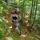
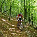
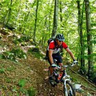
Interesting trail -
Interesting trail -
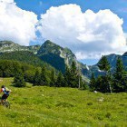
Resting below Golobar meadow -
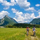
Golobar alpine meadow -
Golobar alpine meadow -
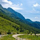
Wonderful descent towards Bovec -
Wonderful descent towards Bovec -
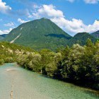
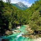
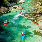
Emerald Soča river -
Emerald Soča river -
Emerald Soča river -
Again in Bovec