| asphalt, dirt road, trail | ||
Starting point:
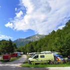
We chose the village of Livek (above Kobarid) as our starting point:
From the center of Kobarid drive towards Tolmin. In the village of Idrsko (near Kobarid) turn right at the road sign for Livek. The asphalt road climbs about 500 altitude meters. It is best to park your car at the football field at the beginning of the village. Google Maps
Description:
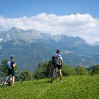
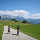
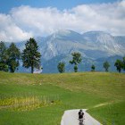
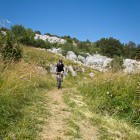
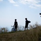
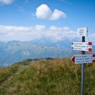
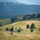
From the football field head to the center of Livek village, where you'll find a signpost for Matajur that will direct you to the right. Asphalt road gently ascends to the hamlet of Avsa and offers a beautiful view of Mt. Krn on the other side of the Soča valley. Follow the main road that turns into a dirt road just above Avsa village. Keep ascending through the forest until you reach the next crossroad: to the left is Matajur and to the right are Matajur alpine meadows ('Matajurske planine') - a nice spot to rest wih a wonderful view.
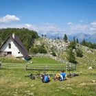
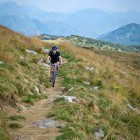
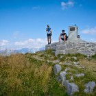
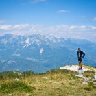
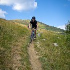
Follow the markings for Matajur and the dirt road slowly turns into a mule track. At some point the footpath to Matajur turns right, but you'll want to follow the mule track that turns left and gently ascends across the grassy south slope of Matajur. You're now in Italy. Follow the beautiful and almost 100% cyclable path all the way to 'Malga Tubolin' where the mountain hut is open on weekends. From Malga Tubolin to the top of Matajur you will have to push your bike or simply go to the summit on foot. At the top you'll find a small chapel and a breathtaking view to a big part of western Slovenia.
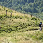
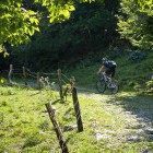
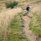
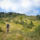
The fun part of the tour starts now. You're in for an almost 1500 altitude meter descent on the Italian side until the village of 'San Pietro al Natisone'. From the top of Matajur descend back to Malga Tubolin. Turn right slightly along the mountain trail where you'll need to carry the bike across some rocks, but from then on it's pure fun! Descend towards south and follow the markings for route 749 at all junctions. In the middle part you'll cross an asphalt road. Soon after be careful not to miss an unmarked path that goes straight ahead (the forest road along which you came turns right here).
The lower part of the descent offers plenty of possibilities. On a marked saddle by the church of San Canziano turn towards the village of Mezzana. Descend on the asphalt road to the bottom of the village where you turn left on a dirt road towards San Pietro (signpost). The descent brings you back to the asphalt road where you can go right to San Pietro or left to the village of Cleina which is a bit closer to our finish point.
If you're tired it's better to turn left, descend into the valley and turn left again (direction Savogna). From here on there's just an uphill ride along a little busy asphalt road back to Slovenia (Livek). 500 meters of altitude difference is quite long and tiresome. The other option is to turn right and return to Slovenia (Kobarid) along the Nadiža river with an optional swim on the way. Once you come back to Kobarid just take a cab to take you to your car in Livek :)
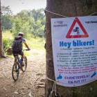
Warning: A part of the descent runs along a singletrail (foot-path). Ride slowly, use your front brakes and don't leave any trails with your rear wheel. Move from the path if you meet hikers. A warm 'hello' and a smile is very welcome.
A tip: If you want to discover the best MTB trails in the Soca valley - BOOK OUR MOUNTAIN BIKE TOUR!
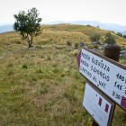
Highest point:
Matajur: 1641 m
Length (duration, km):
Livek - Matajur: 2.30 h (14.5 km)
Matajur - San Pietro: 1.30 h (15.5 km)
San Pietro - Livek: 1.15 h (16 km)
Total: 5.5 h, 46 km
Type of trail:
45% asphalt (21 km)
25% dirt road (11.3 km)
30% singletrail (13.7 km)
Gallery
-
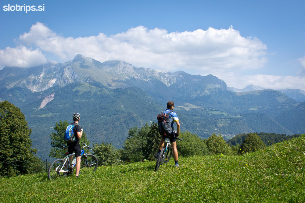
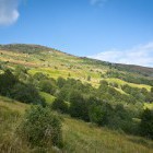
Ascending towards Mt. Matajur -

Ascending towards Mt. Matajur -
Ascending towards Mt. Matajur -
Ascending towards Mt. Matajur -
Ascending towards Mt. Matajur -
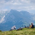
Rest spot on the way to Matajur -
Ascending towards Mt. Matajur -
Ascending towards Mt. Matajur -
Wonderful singletrail to Matajur -
Wonderful singletrail to Matajur -
Wonderful singletrail to Matajur -
Wonderful singletrail to Matajur -
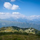
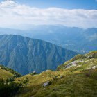
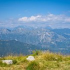
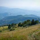
View from the top of Matajur -
View from the top of Matajur -
On the top of Matajur -
View from the top of Matajur -
View from the top of Matajur -
View from the top of Matajur -
MTB descent from Matajur -
MTB descent from Matajur -
MTB descent from Matajur -
MTB descent from Matajur -
MTB descent from Matajur -
MTB descent from Matajur -
Warning for mountain bikers -
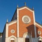
Church in the village of San Pietro