


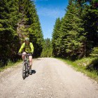
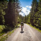
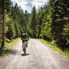
| asphalt, dirt road, trail | ||
Starting point:
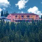
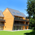
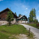
We start the tour on top of Rogla by the hotel and the cable car Planja.
Description:
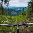
You can start the trip by descending through Bike Park Rogla. Choose a suitable trail and descend to the lower station of the cable car Planja (Mašin Žaga). Turn right behind the artificial lake on a dirt road and move up to the Pesek Hut (Koča na Pesku). Continue straight ahead on the dirt road.
If you want to avoid descending through Bike Park Rogla just descend eastwards along the main road and the asphalt road will take you straight to the Pesek Hut. Turn right and get on the dirt road.
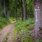
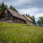
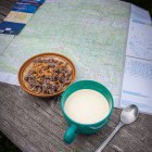
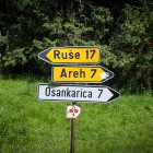
The road descends slightly and after 2.5 km (from the Pesek Hut) you reach a crossroad (where you can see different hiking markings and signposts) where you turn left. Keep on the main road and after approx. 4.5 km you notice a marking and the sign KOČA on a sharp turn right. Leave the main road and follow the marked forest cart track. Shortly you reach the beautiful Klopni Vrh Hut which offers the best sour milk and a fantastic view of Maribor.
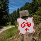
From the hut first, go back in the direction you came from and move ahead on the dirt road. Soon you come to another crossroad where you go straight on (markings šUMIK and OSANKARICA). Follow the narrow dirt road which is nicely marked on all the crossroads: you will see the sign P-T or 2-1. Pay special attention to the crossroad behind a small bridge, where you should keep on the right. Turn left on the next crossroad and you reach the lovely šumik Hut.
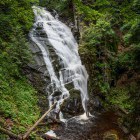
Descend from the hut and turn right at the next crossroad towards OSANKARICA. In a couple of minutes, you will notice signboards for the šumik Rainforest on your left and a marked path that leads to the Big (Veliki) and Small (Mali) šumik Waterfalls. Definitely worth a visit!
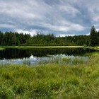
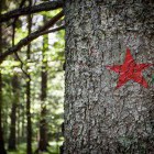
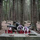
Proceed further on and soon you get to another crossroad. Turn right towards Osankarica and in half an hour you reach the Osankarica Hut. There are two interesting places nearby: the wonderful Lake Black (Črno jezero) and the site of the last battle of the Pohorje Battalion. Leave your bikes at the hut and keep on the right. Soon after the hut, you will notice a path winding up to the right. The path soon flattens out and you follow the markings on the trees (red stars). After a 20-minute walk, you reach this gloomy place where a monument stands today.
Continuing on the cycling trail: Keep on right behind the Osankarica Hut and proceed along the dirt road. Go straight ahead on all the crossroads. You will come to a place which gives the impression that the road ends here. Just go further on and in a few minutes, you will reach the road again, proceed on the dirt road. When you join a bigger dirt road, turn right upwards, and soon you reach a crossroad you have already seen today. Turn left and ascend to the Pesek Hut. Turn left again and move up the last asphalt slope back on top of Rogla.
Highest point:
Rogla: 1500 m
Length (duration, km):
Rogla – the Klopni vrh Hut: 50 min (11 km)
The Klopni vrh Hut – šumik: 40 min (9 km)
šumik – Osankarica: 30 min (6 km)
Osankarica – Rogla: 1h 45min (21 km)
Total: 4h, 47 km
Type of trail:
9% asphalt (4 km)
85% dirt road (40 km)
6% single trail (3 km)
Gallery

-
Rogla - Šumik waterfall - Black lake -

Rogla - Šumik waterfall - Black lake -
Rogla - Šumik waterfall - Black lake -
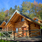
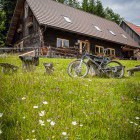
A very nice Hut on Klopni vrh -
A very nice Hut on Klopni vrh -
A very nice Hut on Klopni vrh -
Rogla - Šumik waterfall - Black lake, biking signposts -
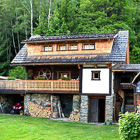
Beautiful Šumik hut -
Rogla - Šumik waterfall - Black lake -
Šumik waterfall -
Rogla - Šumik waterfall - Black lake -
Rogla - Šumik waterfall - Black lake -
Rogla - Šumik waterfall - Black lake -
Path to the Black Lake -
Black Lake -
Path to the setting of the last battle of Pohorje battalion -
Memorial at the setting of the last battle of Pohorje battalion