| asphalt, dirt road, trail | ||
Starting point:
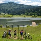
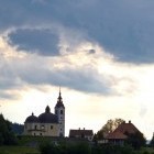
Podpeč lake. Leave the 'Ljubljana-Koper' motorway at Brezovica, turn left at the traffic light and then the signposts lead you through Vnanje and Notranje Gorice to Podpeč. Turn left here towards Ig and at the next crossroad (a bit after a gas station) turn right and you will reach the cute Podpeč lake. There is a restaurant and a big parking lot. It gets quite popular on summer weekends.
Description:
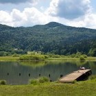
The Podpeč lake itself is a popular spot, especially in the summer-time when it is warm enough for swimming - a well deserved refreshment after the tour! The lake is small but curiously the deepest lake in Slovenia!
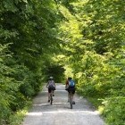
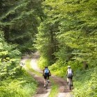
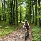
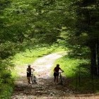
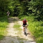
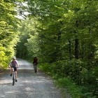
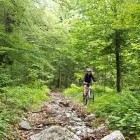
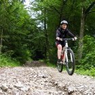
The tour: from the lake return back to the main road, turn left and drive through Podpeč village in the direction of Borovnica. When you reach the crossroad towards Rakitna, continue straight on to the next small crossroad and turn left on a residential street (dead end sign). Drive among houses, continue past a meadow and soon you will reach a steep (but not too long) pebbly slope where many bikers will have to proceed on foot for a few meters. The road takes you to Kamnik Pod Krimom village. You will come to an asphalt road among houses, turn to the left and already after a few meters to the right (otherwise you would reach the main road 'Podpeč – Rakitna' which we want to avoid). Moderately ascending dirt road starts here. After two hairpin turns (keep left) the road straightens and constantly ascends through the forest until it connects with the main asphalt road towards Rakitna. Keep right and drive on the main road for ca. 1 km to a meadow where a dirt road braches off to the left. Turn onto the dirt road, keep right on all crossroads and keep ascending almost parallelly with the main road. The dirt road is quite rough in some places and will be enjoyable only for the well prepared cyclists. You will come to the main road once again after ca. 2 km and continue on it to the signpost for Krim. If you are in a hurry or if you are tired already, turn left towards Krim and a wide dirt road will bring you to the summit of Krim after 8 km. However, I suggest that you make a detour across Rakitna and ascend to Krim on lonely forest roads.
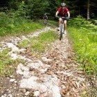
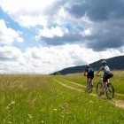
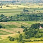
From the mentioned crossroad towards Krim carry on for about 100 meters towards Rakitna and then turn right and descend down a small dirt road (rough at first) to gorgeous meadows, across which you will come to the lake at Rakitna. You can dip your feet into the water, rest and freshen up. There is even a hotel, snack bar and a restaurant there. From the lake go along the main road to Rakitna village (direction Podpeč) where you turn right. Ascend past a church and you will start noticing small 'hiking signposts' for Krim. At the top of the village (where a marked footpath goes directly across a meadow) drive to the right across a farmyard, and continue ascending on a narrow dirt road. A warning that you are entering the 'bear area' »greets« you here. After a gentle descend you will come to a clearing under a power line. Proceed from there for about a kilometer to some kind of a truck turning point in the forest. Turn left onto a narrow forest road. Keep left on the crossroads, cross a meadow with a wooden hunting shack and then a short but steep ascent follows. After that a pleasant and lonesome forest path takes you to a wide dirt road, which ascends from Iška vas village towards Krim. Turn left and around a kilometer later a signpost for Krim directs you to the right. The road is ascending gently but at the end it become steeper and it 'wraps around' the summit of Krim. There is a military base, a bunch of transmitters and a mountain hut, where you can get food and drinks. Unfortunately the trees and antennas deprive us of a better view of the wooded surroundings.
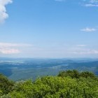
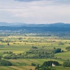
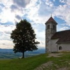
Descent: Return on the same road to the first big crossroad of wide dirt roads. Turn right, ascend a bit and come to a meadow, where a partisan memorial board stands. Just by the memorial turn right onto a lovely forest path, which soon turns into a narrow cart road. Descend on it, cross a wider dirt road and continue on a more overgrown forest path. After a rough descent you will come to a hut (Koča Na Kavcu) and shortly after to a wider dirt road. A fast descend to the main road 'Podpeč – Rakitna' follows. When you reach the asphalt road, descend on it to Preserje village. Follow the main road, ascend a little bit and shortly after Preserje you will notice a red signpost for St. Ana. Follow the markings and go up to the church on a quite rough cart road. The effort for these additional 100 altitude meters is rewarded with a fantastic view on Ljubljana marsh below you and the Alps a bit further away. A steep hiking path descends from a 'saddle' just below the summit directly to the starting point at the lake.
Highest point:
Krim: 1107 m
Length (duration, km):
Podpeč Lake - Rakitna: 1.30 h (14.5 km)
Rakitna - Krim: 1.15 h (10.5 km)
Krim - Podpeč Lake: 1.30 h (16 km)
Total: 4.30 h, 41 km
Type of trail:
24% asphalt (10 km)
62% dirt road (25.5 km)
14% singletrail/tractor road (5.5 km)
Gallery
-
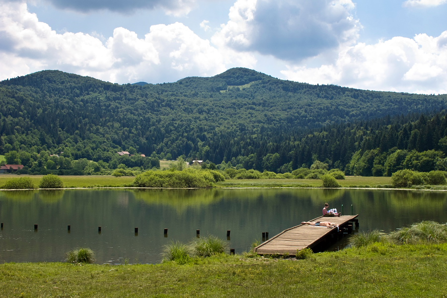
Podpeč lake -

Podpeč lake -
Cart road towards Rakitna -
Off-road -
Cart road is... -
... partly rough... -
.... and steep -
Almost in Rakitna -
Meadows in Rakitna -
Towards the summit of Krim -
View from the summit of Krim -
The difficult part of the descent -
Descending... -
View -
View from St. Ana -
Ljubljana marsh from St. Ana -
Ljubljana marsh from St. Ana -
St. Ana church