Starting point:
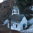
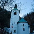
St. Lenart church above Gornji Grad town.
Drive northwards from Kamnik and follow the signposts for Stahovica or Gornji Grad. Ascend across Črnivec Pass and then go down towards the town of Gornji Grad. When you already see the town church in Gornji Grad, turn left towards Lenart (the second signpost for Lenart!!!). Keep on the main road which soon turns into a dirt road. Ascend until a sharp left curve where a signpost for St. Lenart and other hiking markings are. Park by the road.
You can also get to the starting point from Savinja side: Go along the road 'Polzela - Mozirje - Gornji Grad'. At the end of Gornji Grad turn right towards Lenart. Keep on the main road which soon turns into a dirt road. Ascend until a sharp left curve where a signpost for St. Lenart and other hiking markings are. Park by the road.
Description:
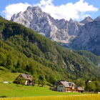
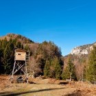
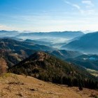
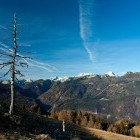
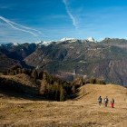
Take on the slope along a steep footpath (direction Lepenatka) just by a hiking board where you parked. A bit higher up you cross a road and follow the signposts to Lepenatka. After the initial steep ascent a dirt road leads you to a hunting observatory on a meadow filled with bracken. Carry on straight up and come onto the grassy slopes of Lepenatka. Ascend along the edge of the forest. Wonderful views open eastwards and at the summit you can admire also the Kamnik-Savinja Alps – all the way from Krvavec ski resort to Mt. Ojstrica. Lepenatka is an extraordinarily lovely summit, suitable for anyone.
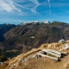
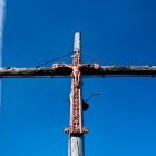
From the summit go down to Kal saddle across the north 'shoulder' of Lepenatka. A very demanding path to the summit of Veliki Rogatec starts here. At first you have to climb a bit, but the route is not exposed. Then comes the toughest section of the tour: a narrow, almost unsecured and very exposed ridge. Although this difficult part is rather short, you have to be used to precipices. Some easy ascending follows afterwards all the way to the summit of Veliki Rogatec. A wooden cross with a bell stands here and there are some wooden benches and lovely grass with an amazing view. Descend on a steep footpath towards north-east from the summit. The path runs through steep forest, is slippery and calls for a careful step. This is certainly the least enjoyable section of the tour. Look for a dirt road at 'Zgornji Špeh' meadow, which descends southwards below a small white chapel. After a short walk past the meadows you march into the forest again. Follow the markings along a dirt road and continue to a cute church of St. Lenart. The church is chained down, so that the devil does not take it… Reach the starting point in 5 minutes on a grassy cart road.
Highest point/summit:
Lepenatka: 1426 m
Veliki Rogatec (Rogac): 1557 m
Duration:
Parking - Lepenatka: 1.30 h
Lepenatka - Veliki Rogatec: 1.15 h
Veliki Rogatec - Parking: 1.15 h
Total: 4 h
Difficulty:
4 - The section between Kal saddle and Veliki Rogatec is very demanding! Some parts are extremely exposed, they run on a narrow ridge and there is almost no safety equipment in the rocks. This is no joke! However, the toughest section is rather short and thus it only got a mark '4'. Descending from Veliki Rogatec is inconvenient since it takes place on a steep and slippery terrain. Other parts of the route are easy.
Type of path: Marked path
Gallery
-
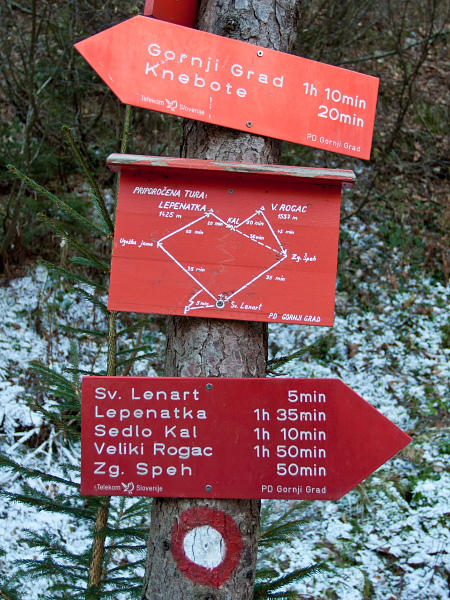
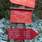
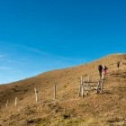
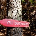
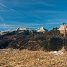
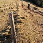
Signposts at the beginning of the path -

Hunters hut below Lepenatka -
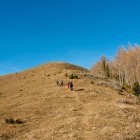
Towards Lepenatka -
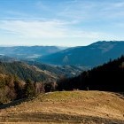
Lepenatka - View back -
Below the summit of Lepenatka -
Below the summit of Lepenatka -
Mt. Ojstrica "peaks" from the horizon -
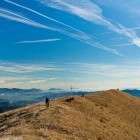
On the summit of Lepenatka -
On the summit of Lepenatka -
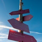
Signposts on the summit of Lepenatka -
On the summit of Lepenatka -
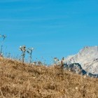
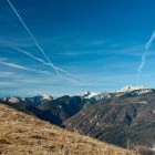
View towards Kamnik-Savinja Alps from the summit of Lepenatka -
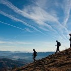
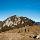
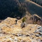
Descent from Lepenatka to Kal saddle; Veliki Rogatec is in front of us -
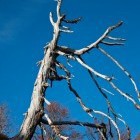
On the way -
On the way -
Descent from Lepenatka to Kal saddle -
Grassy slopes below Lepenatka -
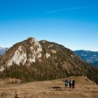
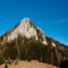
Veliki Rogatec from Kal saddle -
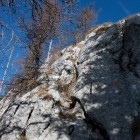
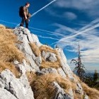
Beginning of the difficult path to Veliki Rogatec -
Veliki Rogatec - Steep path -
Veliki Rogatec - Steep path -
Veliki Rogatec - Steep & exposed path -
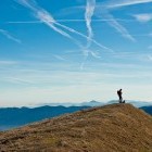
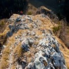
On the summit of Veliki Rogatec -
On the summit of Veliki Rogatec -
On the summit of Veliki Rogatec -
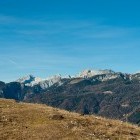
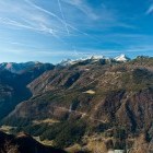
View from the summit of Veliki Rogatec -
View from the summit of Veliki Rogatec -
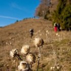
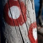
Detail -
Detail -
During descent from Veliki Rogatec -
During descent from Veliki Rogatec -
St. Lenart church near the parking -
Signpost -
St. Lenart church