Gallery
Where to sleep
Basic information
Location
Pokljuka (Bled)
Difficulty


Duration
4 h
Start point elevation
1350 m
Highest point
1350 m
Total vertical climb
530 m
Skiing difficulty
Starting point:
From Bled follow the signposts to Gorje and Pokljuka. Drive through Spodnje and Zgornje Gorje and then the road begins to ascend. Go along the main road all the way to its end where you reach Rudno Polje on Pokljuka plateau. Park on a large parking lot at the end of the road near the sports center (around 1350 m).
Description:
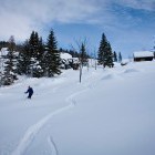
Head southwest from the sports center at Rudno polje along the cross-country skiing tracks. After about 1.5 km a footpath branches off to the left towards Uskovnica (a signpost). It descends a bit to a long meadow. When the meadow gets wider you have two options:
Head southwest from the sports center at Rudno polje along the cross-country skiing tracks. After about 1.5 km a footpath branches off to the left towards Uskovnica (a signpost). It descends a bit to a long meadow. When the meadow gets wider you have two options:
- Go to the right directly towards Uskovnica meadow; the path is quite popular, it takes 1 hour on foot from Rudno polje
- Go to the left towards Praprotnica or Zajamniki meadows; this path is much less popular, it takes 2 hours on foot to reach Zajamniki from Rudno polje.
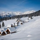
Turn left at the above mentioned meadow (slightly upwards). Follow a small road and soon reach the first houses at Praprotnica alpine meadow. Leave the road and descend across the meadows directly to the south. Once you get to a flatter terrain you find yourself at a crossroad (if there is a lot of snow, the crossroad is less visible). The road to the left goes towards Zajamniki alpine meadow, the one leading straight across the meadow goes to šeh alpine meadow and the one to the right goes towards Uskovnica.
You head left and start ascending gradually along a forest road. After about 2 km you spot a small signpost that guides to the right and in a moment you find yourself on the beautiful Zajamniki alpine meadow. I suggest you cross the meadow and ascend to the wooden shack on a hill right opposite of the meadow. The view from there is superb!
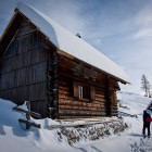
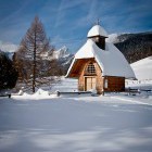
The easiest way to return to Praprotnica meadow is down the same path, but the GPS track offers an alternative descent to šeh meadow which also leads to Praprotnica. When you come to the above mentioned crossroad at Praprotnica meadow again, go along the main road towards Uskovnica (a wooden signpost). Before long, the road merges with the popular 'Rudno polje - Uskovnica' path. Continue towards Uskovnica and arrive shortly to this spacious alpine meadow. There is a beautiful wooden chapel on the top of the meadow and a lovely cottage that is often open during winter a bit lower.
You can either return to Rudno polje along the 'usual' marked path (1 hour) or make a detour across the remote meadows beneath Konjščica alpine meadow (see GPS information).
Highest point/summit:
Zajamniki meadow: 1290 m
Uskovnica meadow: 1150 m
Duration:
Rudno polje – Praprotnica meadow - Zajamniki meadow: 2 h
Zajamniki meadow - Uskovnica meadow: 1 h
Uskovnica meadow - Rudno polje: 1 h
Total: 4 h (warning: it can take much longer, if you are the first one here after snowing!)
Difficulty:
1 - The tour is technically very easy. Orientation from Rudno polje to Uskovnica is not problematic at all since the path is very popular and well marked. The shortcuts leading to Zajamniki and to šeh meadow are a bit more challenging orientation-wise.
Difficulty:
1 - The tour is technically very easy. Orientation from Rudno polje to Uskovnica is not problematic at all since the path is very popular and well marked. The shortcuts leading to Zajamniki and to šeh meadow are a bit more challenging orientation-wise.
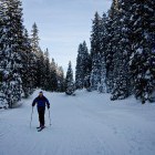
Gallery
-
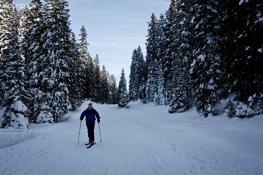
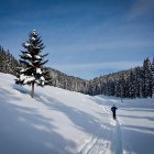
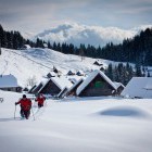
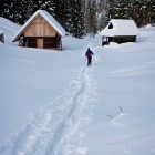
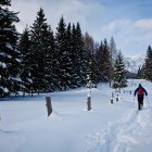
Start along the cross-country tracks -

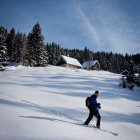
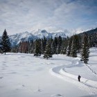
Towards Uskovnica meadow -
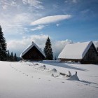
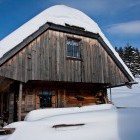
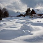
Praprotnica meadow -
Praprotnica meadow -
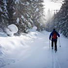
Along the road towards Zajamniki meadow -
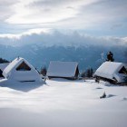
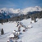
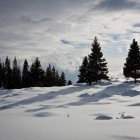
Zajamniki meadow -
Zajamniki meadow -
Zajamniki meadow -
Zajamniki meadow -
Zajamniki meadow -
Zajamniki meadow -
One of the most beautiful alpine meadows - Zajamniki -
Descent from Zajamniki to Šeh meadow -
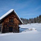
Šeh meadow -
Towards Uskovnica meadow -
Towards Uskovnica meadow -
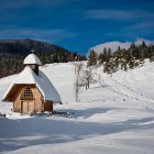
Chapel on Uskovnica meadow -
Chapel on Uskovnica meadow -
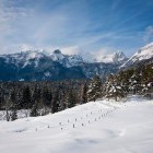
View from Uskovnica meadow -
Uskovnica meadow -
Winter fairytale on Pokljuka alpine meadows


Navigate with arrow keys