Starting point:
Solkan. In Nova Gorica go in the direction of Tolmin or Solkan. Park on the north edge of Solkan on a neat parking lot in front of a big bridge over Soča River (where a signpost for Goriška Brda stands).
Description:
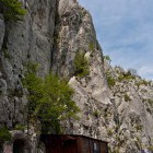
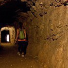
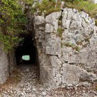
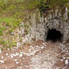
Cross the Solkan bridge and look for a hiking signpost on the left side of the bridge, which directs you under the bridge itself. Descend to a cart road, which runs along the right bank of Soča River. Follow Soča and after about half an hour a signpost will direct you left into the forest. The path begins to ascend and brings you to the first caverns (military tunnels) just below 'Koča Na Sabotinu' hut without any orientation or technical problems. The caverns are partially lit, but you should still bring a flash light to visit them. Sabotin is literally scattered and pierced through with caverns, which the Austro-Hungarian soldiers started building in 1915. Defense positions, shelters and warehouses were in there. When Italians took over Mt. Sabotin, they broke down the walls towards Sveta Gora on the other side of Soča River and pointed cannons at it.
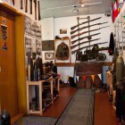
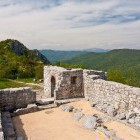
Through the caverns or along the marked path you will come to 'Koča Na Sabotinu' hut, where a small memorial room with photographs and old arms is. North from the hut you can access the system of caverns, through which you can walk and relive the tough life of the soldiers in these humid tunnels. You will also see Italian cannon positions, from where they were shooting to the other side of Soča River.
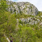
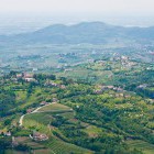
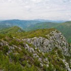
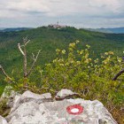
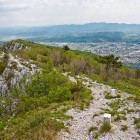
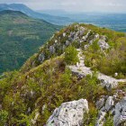
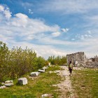
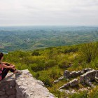
From the hut you head back towards south-east and follow a marked path, which runs on a panoramic ridge. Along the Italian – Slovenian border you will soon come to Sabotin summit and proceed forward along the ridge to the ruins of St. Valentin church. The path starts descending steeply towards Gorica here. Go down on a gravel path until you reach the road which you just cross and continue on the path. Once you come to the road for the second time, follow it to the left and you are already at the Solkan bridge again.
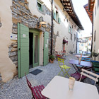
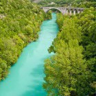
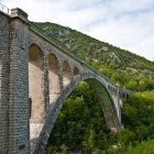
This tour is possible throughout the whole year; it can get pretty hot in summer and you might surprise a snake, having a sun-bath. When you return to the starting point you should simply drive a couple 100 meters towards Tolmin to Ošterija Žogica restaurant, take a look at the wonderful Solkan railway bridge (the largest stone arch in the world!) and indulge in a delicious lunch by the emerald Soča River.
Highest point/summit:
Sabotin: 609 m
Duration:
Solkan - 'Koča na Sabotinu' hut (north path): 1.30 h
'Koča na Sabotinu' hut - Sabotin: 0.15 h
Sabotin - Solkan (south path): 1.15 h
Total: 3 h
Difficulty:
1 - The entire route is technically easy. Some caution is needed only when you walk through the caverns.
Type of path: marked path
Gallery


-
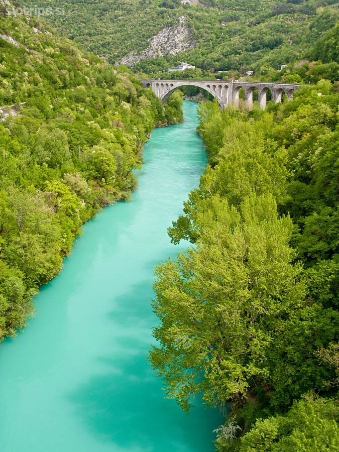
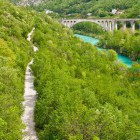
View from the road to the railway bridge in Solkan -

Start of our path in Solkan -
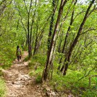
Northern path to Sabotin -
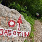
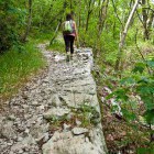
Sabotin - Turn left into the forest -
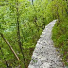
Sabotin - Ascent -
Sabotin - Ascent -
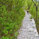
Sabotin - Interesting path -
Sabotin - Ascent -
Sabotin - First caverns -
Sabotin - Walk through the caverns -
Sabotin - Museum room in the hut -
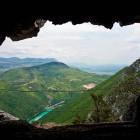
Sabotin - View towards Goriška Brda from the hut -
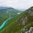
Sabotin - View towards Soča river -
Sabotin - Italian battle positions -
Sabotin - Caverns -
The neighboring "Sveta gora" (= Holy Mountain) -
Sabotin - Caverns -
Sabotin - On the ridge -
Sabotin - On the ridge -
Sabotin - Nice view -
Sabotin - Walking towards Gorica -
Sabotin - On the ridge -
Sabotin - On the ridge -
Sabotin - St. Valentin ruins -
Sabotin - St. Valentin ruins -
Sabotin - View towards Italy and Goriška Brda -
Sabotin - Descent -
Solkan railway bridge -
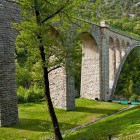
Solkan railway bridge -
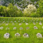
Military cemetery in Solkan -
Military cemetery in Solkan